24/10/2023 - E +10 SITREPS
As at 2.48pm on 24/10/2023 prepared by Crispian
approved by Anusha Guler
Distributed
All GEDT/ELT members
to
Key
Anusha Guler and Crispian
Contacts
Previous
E+6 SITREPS 6 20102023 - FINAL.docx
ELT SITREP
Overview
Summary of the current event
• Post election process
Voting
GENERAL UPDATE
Services
Overseas Operations
• No issues to report.
• Processing continues. Last shipment of voting papers from Overseas Voting Places arrives today.
• Validation and qualification progressing well.
Auckland North Region
• No issues to report.
• Northland electorate ordinary votes count finishes by tonight.
Auckland South Region
• No issues to report.
• Processing 18k Special Votes for the Tāmaki Makaurau and Manurewa electorates, some staff worked on
Monday (Labour Day)
• 1 scrutineer at Port Waikato.
Central North Island Region
• No issues to report.
• 7 out of 12 electorates have completed the official count, remaining will be finished by today.
• Progressing with Special Votes processing in varying stages across the region.
• Dual votes progressing very well.
• 1 scrutineer at Hamilton East.
Lower North Island Region
•
• 7 out of 12 electorates have completed the official count with another two having less than five counts to
complete. Remaining three electorates have an average of 75% complete.
• Special and Dual votes processing is well underway in all electorates.
• Working on an OIA request regarding a voting place that did not open on Election Day.
• 1 scrutineer at Palmerston North
South Island Region (Emma
was in attendance)
• 14 out 16 electorates have completed the official count.
• 1 scrutineer at Nelson electorate
Enrolment
GENERAL UPDATE:
• 24,574 enrolment forms to key. Team working very hard to complete keying before finishing tonight –
which will allow us to process SVDs (Special Votes Declaration) in the morning.
• Port Waikato by-election electoral roll and Easy Vote data extraction and QA completed this morning.
• 50K Special Vote Declarations (SVD) in the queue to be processed by tomorrow morning.
IT
GENERAL UPDATE: (apology from Paul) • No issues to report.
Comms &
GENERAL UPDATE:
Education
• No issues to report.
• Some concern being expressed in media including from political leaders about the time taken to release
official results, specifically because results were previously released in two weeks rather than the current
three.
Customer
GENERAL UPDATE (apologies from Grace)
Services
• No issues to report.
Legal &
GENERAL UPDATE
Policy
• No issues to report.
Strategic
GENERAL UPDATE (Eileen was in attendance)
Engagement
• No issues to report.
and
Partnership
Security
GENERAL UPDATE
For situational awareness only
• Increased gang activity in Wellington, Napier and Tairawhiti
• Coronial enquiry into Christchurch Mosque attacks currently underway in Christchurch
• Ongoing protests about Israel/Gaza conflict nationwide
People &
GENERAL UPDATE:
Culture
• No issues to report.


UNCLASSIFIED
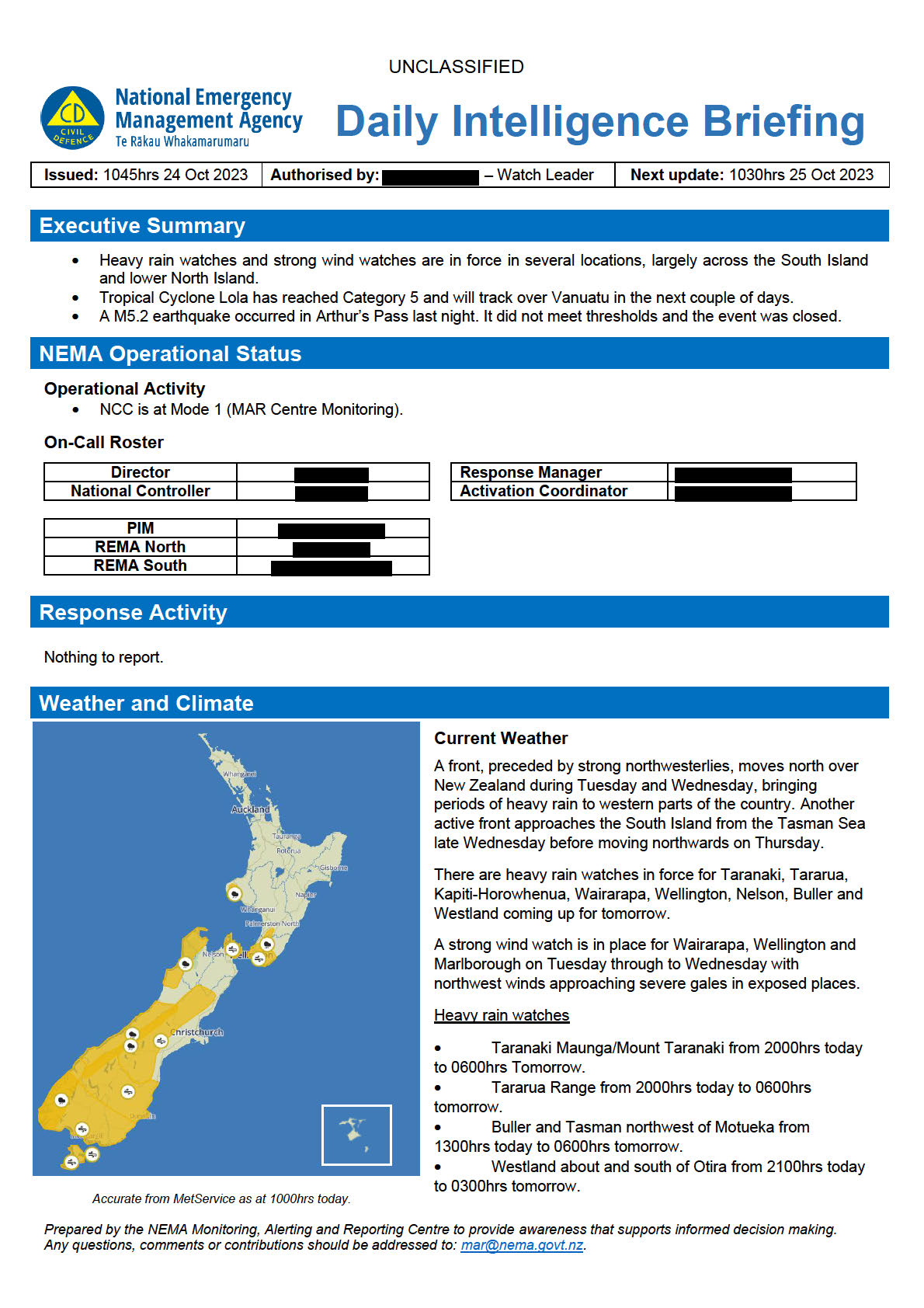
• Headwaters of Canterbury and Otago Lakes and rivers, about and south of Arthur’s Pass from 2100hrs today to
1200hrs Thursday 26 October
• Fiordland from 1800hrs today to 0600hrs Thursday 26 October.
Strong wind watches
• Wairarapa south of Carterton, Wellington and the Marlborough Sounds from 2000hrs today to 0600hrs
tomorrow.
• Canterbury High Country from 2100hrs today to 1100hrs Thursday 26 October.
• Otago excluding Clutha from 1800hrs today to 0600hrs Thursday 26 October.
• Fiordland, Southland including Stewart Island and Clutha from 1500hrs today to 0300hrs Thursday 26 October.
Severe Weather Outlook
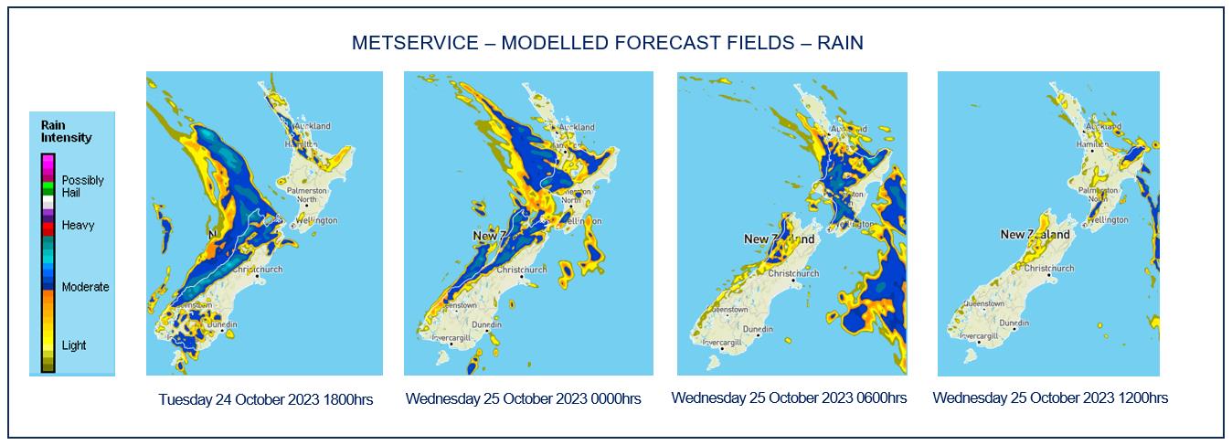
Tomorrow, a front preceded by a strong moist north
westerly flow moves east onto the south of the South
Island. There is moderate confidence that rainfall
amounts will reach warning criteria in Fiordland and
a moderate confidence that severe northwesterly
gales will affect the Canterbury high country, Otago,
Southland and Fiordland. There is low confidence
that rainfall over the North Island ranges south of
Lake Taupo will reach warning amounts.
On Thursday, the front moves northeast over the
South Island and onto the lower North Island. There
is high confidence that rainfall accumulations will
reach warning amounts in Fiordland, Westland,
Buller and the headwaters of the Otago and
Canterbury lakes and rivers. There is moderate
confidence in severe northwest gales for the
Canterbury high country and foothills, Marlborough,
Wellington and Wairarapa south of Carterton. There
is again low confidence that rainfall over the North
Island ranges south of Lake Taupo will reach
warning amounts.
A strong cold southwesterly flow is expected to affect
the South Island on Friday.
Prepared by the NEMA Monitoring, Alerting and Reporting Centre to provide awareness that supports informed decision making.
Any questions, comments or contributions should be addressed to: [email address].


UNCLASSIFIED
Severe Thunderstorm Warnings
A front in the Tasman Sea moves onto the South
Island during the second half of today.
As the front moves northwards along the South Island
west coast, there is a moderate risk of a few
thunderstorms embedded within broader areas of rain
about northern Fiordland this afternoon, and
Westland, Buller and far western Tasman this evening
and tonight. Any thunderstorms that occur in these
areas will boost local rainfall rates.
There is also a moderate risk of a few thunderstorms
about Southland and southern parts of Otago in the
late afternoon and evening, and a moderate risk of
one or two thunderstorms about North Otago, South
Canterbury and Marlborough Sounds tonight.
If any thunderstorms do occur in these areas, they will
bring brief heavy rain and small hail.
Fire and Drought Risk
Source: NIWA Fire Weather
Prepared by the NEMA Monitoring, Alerting and Reporting Centre to provide awareness that supports informed decision making.
Any questions, comments or contributions should be addressed to: [email address].


